Showing posts with label Maps & flags. Show all posts

January 30, 2020

3407 ROMANIA - Puzzle map of Romania - series of postcards

3407 The summary of the series
"100 years since the Great Union of Romania"

At the initiative of Mihnea Răducu, between 1st December 2017 and 1st December 2018, so in the year in which the Romanians celebrated the centenary of the Great Union, took place every month a meeting of the Romanian postcrossers, and at each meeting has been edited a postcard to recall this exceptional event for the Romanians. 
  
The all 12 postcards of the series
"100 years since the Great Union of Romania"

Moreover, each postcard contains a fragment from the outline of the borders of Romania and a letter, such that if you put together all the 12, you make on one side the map of Romania and on the other side the word "Postcrossing". Finally, Mihnea edited a postcard to solve this puzzle (3407). The 12 postcards can be seen here: 

P - Second Train Postcrossing Meetup, 24 February 2018
O - Postcrossing Meetup, Cornu, 15 September 2018
S - Postcrossing Meetup, Iaşi, 24 March 2018
T - Postcrossing Meetup, Chișinău, 23 June 2018
C - Postcrossing Meetup, Bucharest, 20 January 2018
R - Postcrossing Meetup, Bucharest, 2 December 2017
O - Postcrossing Meetup, Bucharest, 14 July 2018
S - Postcrossing Meetup, Bucharest, 17 June 2018
S - Postcrossing Meetup, Curtea de Argeş, 11 November 2018
I - Postcrossing Meetup, Bucharest, 1 December 2018
N - Postcrossing Meetup, Bucharest, 5 May 2018
G - Postcrossing Meetup, Bucharest, 7 October 2018 


January 9, 2020

0541, 3342 LATVIA - The map and the flag of the country

3342

Posted on 05.03.2013, 09.01.2020
Located between Lithuania and Estonia, with outlet to the Baltic Sea, Latvia is one of the least populous and least densely populated countries of the European Union. More than 1,000 years ago, four Baltic tribes inhabited Latvia (Curonians, Latgalians, Selonians, and Semigallians), as well as the Livonians, speaking a Finnic language. Conquered in the 13th century by Teutonic Knights (who Christianized, with the sword, the indigenous tribes) it formed, together with Southern Estonia, the crusader state that became known as Terra Mariana or Livonia.

0541 The map of Latvia in 1919

In 16th century it fell under Polish and Lithuanian rule, and in the following two centuries it has been involved in a struggle between the Polish-Lithuanian Commonwealth, Sweden, and Russia for supremacy in the eastern Baltic. Northern Livonia was conquered by Swedish, and throughout the 18th century Russia gradually occupied the whole territory, and so things remained until 1991, with only two interruptions (1918-1939 and 1941-1944).

January 3, 2020

0555-0557, 3319, 3327 BULGARIA (Burgas) - Ancient City of Nessebar (UNESCO WHS)

3319 The Ancient City of Nessebar

Posted on 15.03.2013, 31.12.2019, 03.01.2020
For miles, the road from Varna to Nessebar creeps like a snake along the coast, through the forests where coniferous and deciduous mix like the ethnic groups in the Balkans. But that's not what saw with three millennia ago the Thracians, who came from inland to built the settlement named Menebria, neither the Greeks, who came from the sea to lay the foundations of the prosperous colony named Mesembria. In 71 BC the town fell under Roman rule, yet continued to enjoy privileges, and from the 5th century AD onwards had become one of the most important strongholds of the Byzantine Empire.

0555 A bird's-eye view of the Ancient City of Nessebar

In the following centuries it passed several times from the hands of the Byzantines in those of the Bulgarians, and even of the Crusaders in 1366. The Bulgarian version of the name, Nesebar or Mesebar, has been attested since the 11th century. Conquered by the Ottomans in the same year as Constantinople (1453), it gradually declined until returned to Bulgaria in 1885, becoming since the beginning of the 20th century a key Bulgarian seaside resort.

3327 Vernacular wooden houses in Nessebar
 

As an "outstanding testimony of multilayered cultural and historical heritage", a place where many civilizations left their tangible traces, from the Dorians Black Sea colony's structures to the churches from the Middle Ages and the vernacular wooden houses built in the 19th century, Nessebar was included on the list of UNESCO WHS under the name Ancient City of Nessebar. It is sometimes said to be the town with the highest number of churches per capita, because a total of forty churches had survive, wholly or partly, in the vicinity of the town. Its ancient part is situated on a little peninsula, previously an island, linked with the mainland with only a relatively narrow passageway.

0556 The Church of Christ Pantocrator in Nessebar

One of them is the Church of Christ Pantocrator, constructed in the 13th-14th century and best known for its exterior decoration, rich and colourful. Designed in late Byzantine cross-in-square style, was builded from stones and brickwork, a construction technique known as opus mixtum. The best-known feature of the Church of Christ Pantocrator is the rich and colourful decoration of its exterior walls. Used today as art gallery, is among Bulgaria's best preserved churches of the Middle Ages.

0557 The windmill on the passageway from New Nessebar to Old Nessebar

The Old Windmill shown in the third postcard, located on the passageway from New Nessebar to Old Nessebar, is a lovely, very intact Black Sea style wildmill. Aren't known too much about it, but it's supposed that was built in the Bulgarian revival period from the 17th to the 19th century. The building have a rough style, the design being entirely functional. The windmill base reveals a wooden guiderail and direct wood-to-wood contact.

January 2, 2020

3325 SAINT KITTS AND NEVIS - The maps of the islands


Located in the eastern Caribbean Sea, in the Leeward Islands, Saint Kitts and Nevis is the smallest sovereign state in the Americas, in both area and population (261 km2 and 53,000 inhabitants in July 2019). The country is a Commonwealth realm, with Elizabeth II as queen and head of state. The islands were discovered through a Spanish expedition under Columbus in 1493, and was home to the first British and French colonies in the Caribbean, being titled "The Mother Colony of the West Indies."

December 10, 2019

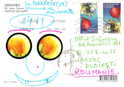
2040, 2041, 2084, 2214, 2664, 2742, 2826, 3287 FRANCE (Auvergne-Rhône-Alpes) - Grenoble

2040 The map of Isère department and The Bastille in Grenoble

Posted on 16.11.2015, 29.11.2015, 14.01.2016, 23.07.2016, 06.09.2016, 15.10.2016, 10.12.2019
Located at the foot of the French Alps, where the river Drac joins the Isère, Grenoble is the capital city of the Isère department. The proximity of the mountains, as well as its size, has led to the city being known as the "Capital of the Alps". Its history goes back more than 2,000 years, at a time when it was a small Gallic village. While it gained in stature by becoming the capital of the Dauphiné in the 11th century, it remained for most of its history a modest parliamentary and garrison city on the borders of the Kingdom of France.

2742 Aerial view of Grenoble

The Bastille, an ancient series of fortifications at the south end of the Chartreuse mountain range, overlooking the city of Grenoble, was begun in the Middle Ages, but later years saw extensive additions, including a semi-underground defense network, credited as the most extensive example of early 18th-century fortifications in France, and then held an important strategic point on the Alpine frontier with the Kingdom of Savoy. A small garrison was maintained in the fort until 1940.

2826 The Palace of the Parliament of Dauphiné
 

The Palace of the Parliament of Dauphiné was constructed in Place Saint André around 1500 and extended in 1539. It was the location of the Parlement of Dauphiné until the French Revolution. It then became a courthouse until 2002. The left wing of the palace was extended in 1897. The front of the former seat of the nearby Dauphiné Parlement combines elements from a gothic chapel and a Renaissance façade. The building now belongs to the Isère Council (Conseil Général de l'Isère).

2041 Grenoble - The Isère's quai, the Bubbles,
the Marius Gontard Bridge, and Vercors Massif.

The Marius Gontard Bridge is historically the second Isère crossing site in Grenoble. The first stone bridge was built between 1621 and 1671. After much destruction and reconstruction, it was rebuilt in stone in 1839 and called the bridge of the Hospital. It carries since 1924 the same name as the street that continues, that of a General Counsel of Grenoble (1856-1923). With a total length of 73m, it has three spans, the central span, the longest, with a range of 27m.

2084 Grenoble - The Isère's quai on wintertime, and the Bubbles.

The first cable transport system was installed on the Bastille in 1875. Since 1934, the Bastille has been the destination of the Grenoble-Bastille Cable Car, known to locals as Les Bulles (the bubbles). It is one of the oldest urban cable cars in the world and runs all year round. The route takes the cars across the Isère and over the roofs of the old Saint Laurent quarter before passing over a bastion of the curtain wall of the fort and then over the Rabot and various successive fortifications before arriving at the upper station.


2214 Grésivaudan Valley - Funiculaire de Saint-Hilaire du Touvet,
villages with Belledone in background, Dent de Crolles, and the Bubbles.

Except for a few dozen houses on the slopes of the Bastille hill, Grenoble is exclusively built on the alluvial plain of the Isère and Drac rivers at an altitude of 214 metres. As a result, the city itself is extremely flat. Mountain sports are an important tourist attraction in summer and winter. Twenty large and small ski resorts surround the city, the nearest being Le Sappey-en-Chartreuse, which is about 15 minutes' drive away. Historically, both Grenoble and the surrounding areas were sites of heavy industry and mining.

2664 Grenoble
 

In 1987, Grenoble became the second French city to reintroduce trams, the first being the Nantes tramway. The current network is 35-kilometre long, and comprises five lines: lines A, B, C, D and E. Trams were first introduced to Grenoble in 1894, and this first generation tram system survived until 1952. The city is served by a total of 103 trams: the older 53, numbered from 2001 to 2053, are Alsthom TFS, whilst the newer 50, numbered from 6001 to 6050, are Alstom Citadis trams.

3287 Grenoble
 

December 3, 2019

3260, 3280 IRELAND / UNITED KINGDOM (Northern Ireland) - The map of the island

3260

Posted on 04.02.2018, 03.12.2019
Located in the North Atlantic, Ireland is the third-largest island in Europe (after Great Britain and Iceland), separated from Great Britain to its east by the North Channel, the Irish Sea, and St George's Channel. Politically, the island is divided between the Republic of Ireland (with Dublin as capital city), which covers five-sixths of the island, and Northern Ireland (with Belfast as capital city), which is part of the United Kingdom. In 2011, the population of Ireland was about 6.6 million (under 4.8 million in the Republic of Ireland and over 1.8 million in Northern Ireland).

3280

The island's geography comprises relatively low-lying mountains surrounding a central plain, with several navigable rivers extending inland. The island has lush vegetation, a product of its mild but changeable climate which is free of extremes in temperature. As of 2013, the amount of land that is wooded in Ireland is about 11% of the total, compared with a European average of 35%. The Irish climate is very moderate and classified as oceanic. As a result, winters are milder than expected for such a northerly area. Rainfall and cloud cover are abundant.

November 28, 2019

3270 GREECE (Eastern Macedonia and Thrace) - The map of Thassos


Lying close to the coast of Eastern Macedonia, Thassos, the northernmost major Greek island, is geographically part of the North Aegean Sea, but administratively belongs to the Kavala regional unit. It is formed mainly by gneisses, schists and marbles of the Rhodope Massif, and is of generally rounded shape. The terrain is mountainous but not particularly rugged, rising gradually from coast to centre. Pine forest covers much of the island's eastern slopes. Thassos is also the name of the largest town (officially known as Limenas Thassou, "Port of Thassos"), situated at the northern side, opposite the mainland and about 10 kilometres from Keramoti.

January 8, 2018

3239 GERMANY - The map of West Germany (1949-1990)


Germany became a nation state in 1871, when most of the German states unified into the Prussian-dominated German Empire. After WWI and the revolution of 1918-1919, the Empire was replaced by the parliamentary Weimar Republic. The Nazi seizure of power in 1933 led to the establishment of a dictatorship, WWII and the Holocaust. After Germany surrendered, the Allies partitioned Berlin and Germany's remaining territory into four military occupation zones (three western sectors, controlled by France, the United Kingdom, and the United States, and a eastern sector, controlled by Soviet Union).

January 6, 2018

2463 UNITED STATES (Michigan) - The lighthouses in Michigan

2463-1
2463-2

Posted on 16.04.2016, 06.01.2018
Michigan is the only state to consist of two peninsulas, separated from the Straits of Mackinac, a 8km channel that joins Lake Huron to Lake Michigan. The state has the longest freshwater coastline of any political subdivision in the world (almost 5,000 km), being bounded by four of the five Great Lakes, plus  Lake Saint Clair. It has also more lighthouses than any other state (about 150). The first lighthouses in Michigan were built between 1818 and 1822, to project light at night and to serve as a landmark during the day to safely guide the ships traveling the Great Lakes.

January 2, 2018

2702-2704, 3232 UNITED STATES (New York) - Manhattan

2702 Manhattan (1)

Posted on 21.08.2016, 02.01.2018
Manhattan is the most densely populated borough of New York City, its economic and administrative center, and the city's historical birthplace. It consists mostly of Manhattan Island, bounded by the East, Hudson, and Harlem Rivers, and also includes several small adjacent islands and Marble Hill, a small neighborhood on the U.S. mainland. It is often described as the cultural and financial capital of the world and hosts the United Nations Headquarters.

2703 Manhattan (2)

Anchored by Wall Street in the Financial District of Lower Manhattan, New York City has been called both the most economically powerful city and the leading financial center of the world. Historically documented to have been purchased by Dutch colonists from Native Americans in 1626, for 60 guilders (1050 USD today). Manhattan real estate has since become among the most expensive in the world, with the value of Manhattan Island, including real estate, estimated to exceed 3 trillion USD in 2013.

2704 Manhattan (3)

Many districts and landmarks in Manhattan have become well known, as New York City received a record of nearly 60 million tourists in 2015, and Manhattan hosts three of the world's 10 most-visited tourist attractions in 2013: Times Square, Central Park, and Grand Central Terminal. The borough hosts many world-renowned bridges and skyscrapers such as the Empire State Building. The City of New York was founded at the southern tip of Manhattan, and the borough houses New York City Hall, the seat of the City's Government. 

3232 Bird's-Eye View of Manhattan / 1891 

The skyscraper, which has shaped Manhattan's distinctive skyline, has been closely associated with New York City's identity since the end of the 19th century. From 1890 to 1973, the world's tallest building was in Manhattan, with nine different buildings holding the title. The former Twin Towers of the World Trade Center were located in Lower Manhattan. At 417 and 415m, the 110-story buildings were the world's tallest from 1972, until they were surpassed by the construction of the Willis Tower in 1974. One World Trade Center is currently the tallest building in the Western Hemisphere.